
Shade
Press kit — Version française
In one sentence
SHADE builds running, cycling and hiking loops that follow real shade — tree canopy, terrain and buildings — and tells you what it will actually feel like, in degrees, at every point of the route.
SHADE trace des boucles de course à pied, de vélo et de randonnée qui suivent l'ombre réelle — celle des arbres, du relief et des bâtiments — et dit la température qu'il fera vraiment, en degrés, à chaque point du parcours.
Background
In summer, which route you take matters as much as when you go out. At 6 pm in a European city in July it is still above 30 °C, and existing route apps send runners down wide sunlit roads: they optimise for distance, elevation or popularity — never for exposure to the sun.
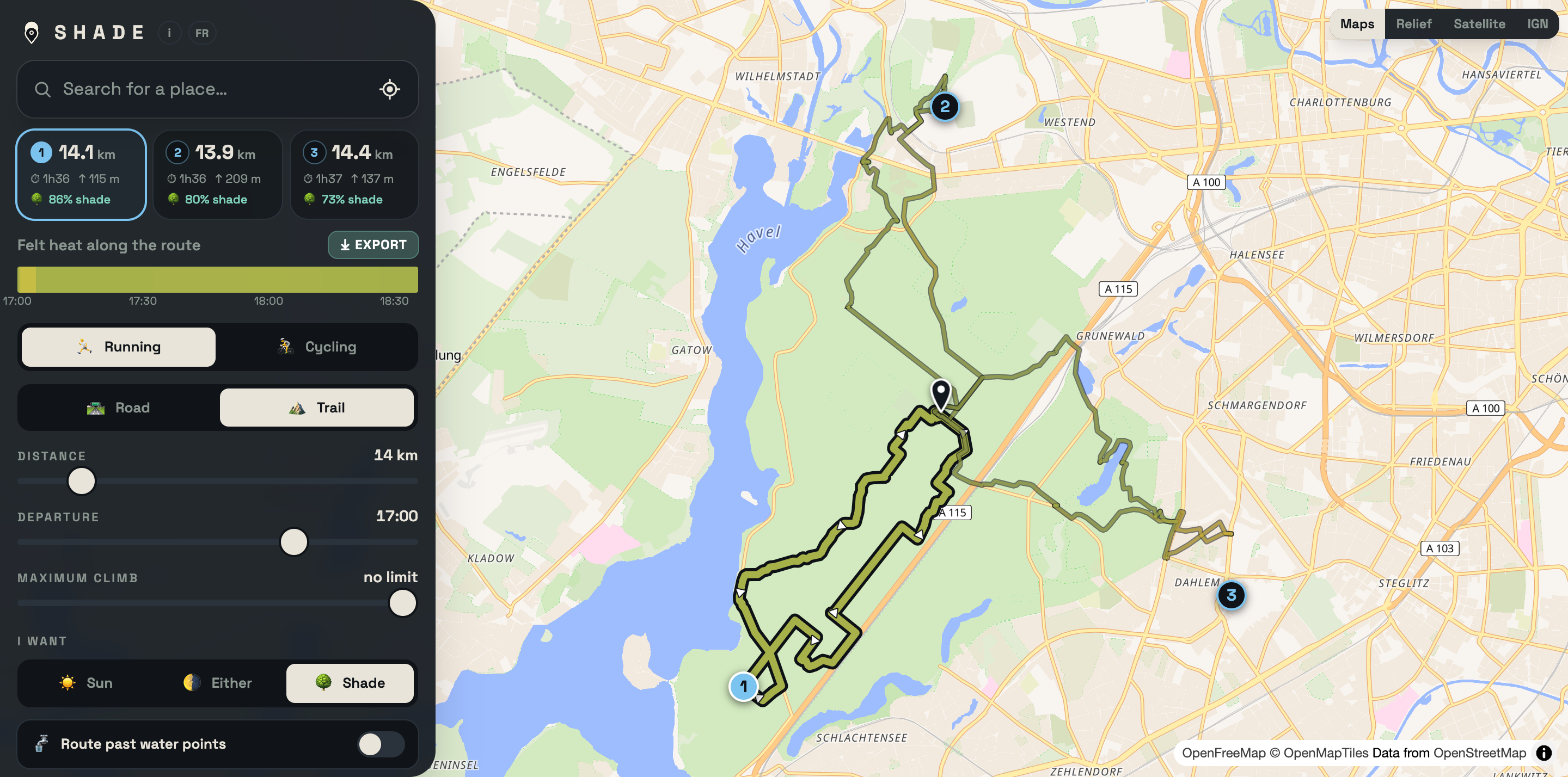
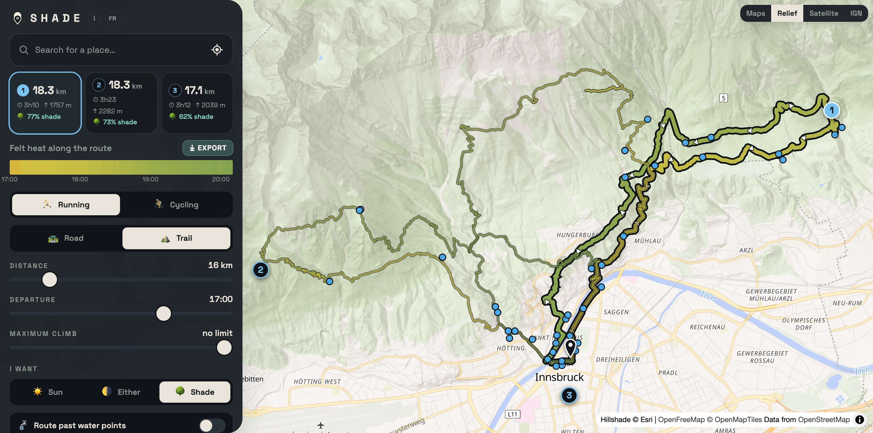
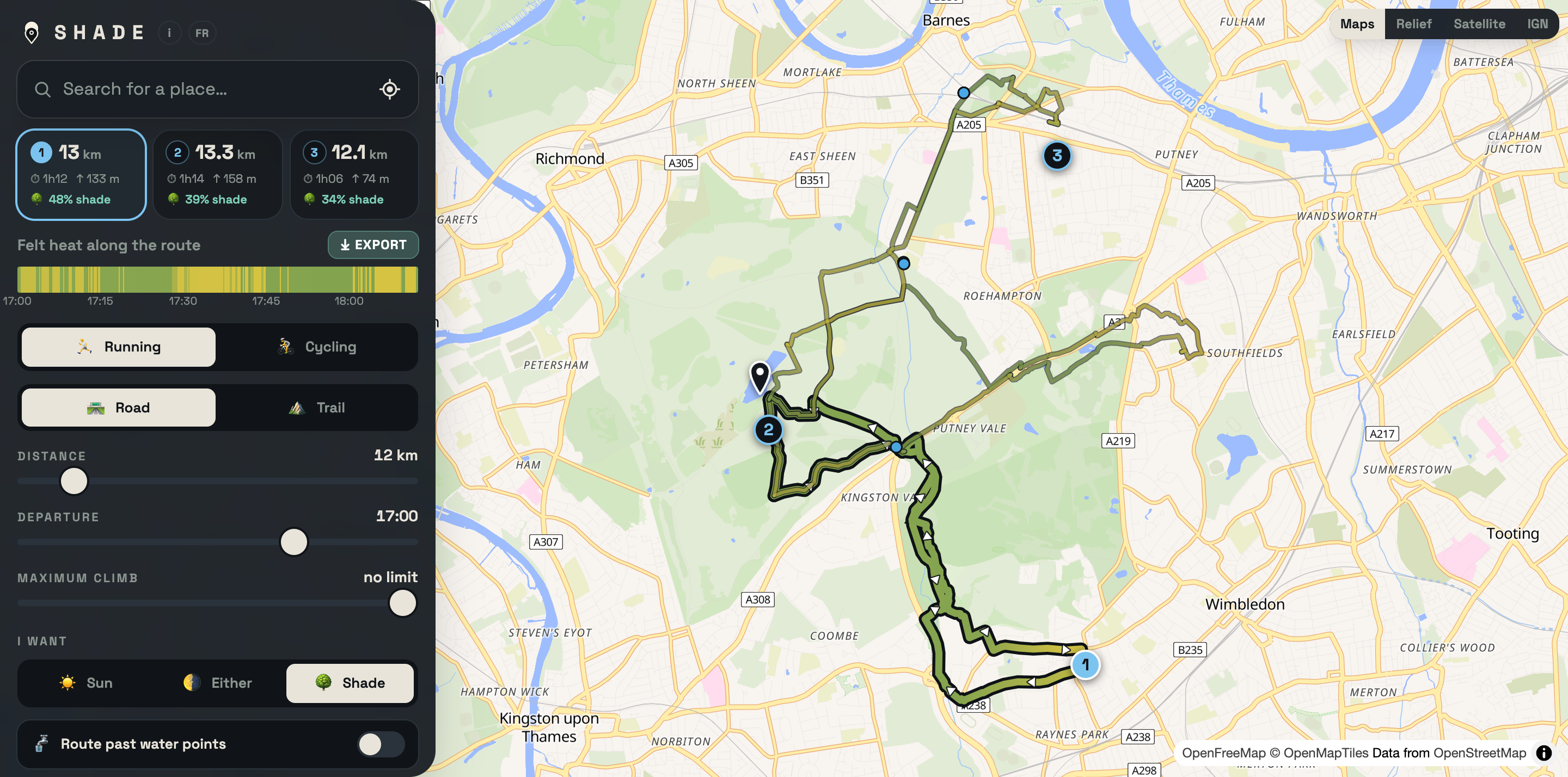
SHADE starts from the opposite problem. For the departure time you choose and today's date — the sun sits differently through the seasons — it computes shade on the ground from three real sources: tree canopy, shadows cast by the terrain, and shadows cast by buildings at their real height. Those three are not worth the same in comfort, and the tool weights them accordingly: under trees the air itself is cooler, whereas a shaded street keeps radiating heat from the tarmac. The percentage shown is therefore felt shade, not simply shaded ground.
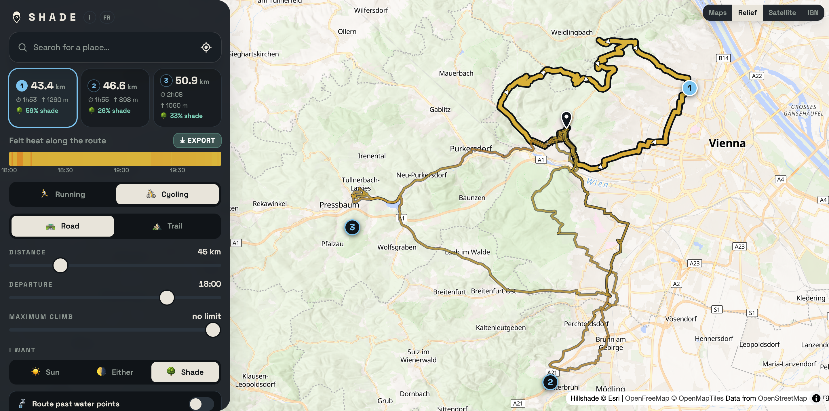
It then builds the network of roads and paths around your starting point, looks for genuine loops in every direction, and offers three that differ from each other. The service is free, with no advertising and no cookies; routes export as GPX to a watch or head unit (Garmin, Strava, Komoot, Suunto, Wahoo). It works worldwide, with quality tracking OpenStreetMap coverage of woods and buildings — so it is at its best across Europe. A free account exists but is never required: all it does is carry your settings from one device to the next.
What is new
A temperature, not an index. SHADE no longer shows an abstract score but a felt temperature in degrees, at every point of the route and at the minute you get there. It combines air temperature corrected for altitude (−6.5 °C per 1000 m), humidity, wind, the solar radiation that really reaches that spot — this is where the computed shade comes in — and the radiation the body loses to the sky. Formula: Steadman's apparent temperature (Australian Bureau of Meteorology) with net radiation. Shown in °C or °F. It deliberately does not account for your own effort: the heat a body produces depends on its weight, its pace and its clothing, and guessing it would turn an honest figure about the environment into a personal fiction.
Hiking joins running and cycling, on trails only.
Your speed enters the calculation. You give one thing — your average speed on the flat — and the engine derives your pace uphill, downhill, and depending on whether the ground is a smooth track or a boulder field, in order to know what time you will be where. That is what decides where the sun will be when you get there: a hiker at 4.5 km/h and a runner at 12 km/h do not meet the same sun. The model rests on the metabolic cost of running on a gradient (Minetti), on Tobler's hiking function for walking, and on a power balance for cycling; how technical the ground is comes from the map itself.
Two services now sit alongside the loop generator. My track: drop in a GPX you already have and SHADE works out its sun exposure and felt temperature all the way along, with only two settings — when you set off and how fast you go. Races: for UTMB, CCC, OCC, the Diagonale des Fous and Western States, a runner enters the checkpoint times they are aiming for and gets their expected heat exposure, checkpoint by checkpoint, altitude included — enough to plan hydration and fuelling before the start.
On weather, one clear rule. Beyond about a fortnight, no model has anything to say. So SHADE does not manufacture a forecast: it serves the weather actually observed on the same date in a previous year (ECMWF's ERA5 reanalysis) and says so, in as many words, above the figures. A race nine months away gets last year's weather, or nothing.
Screenshots
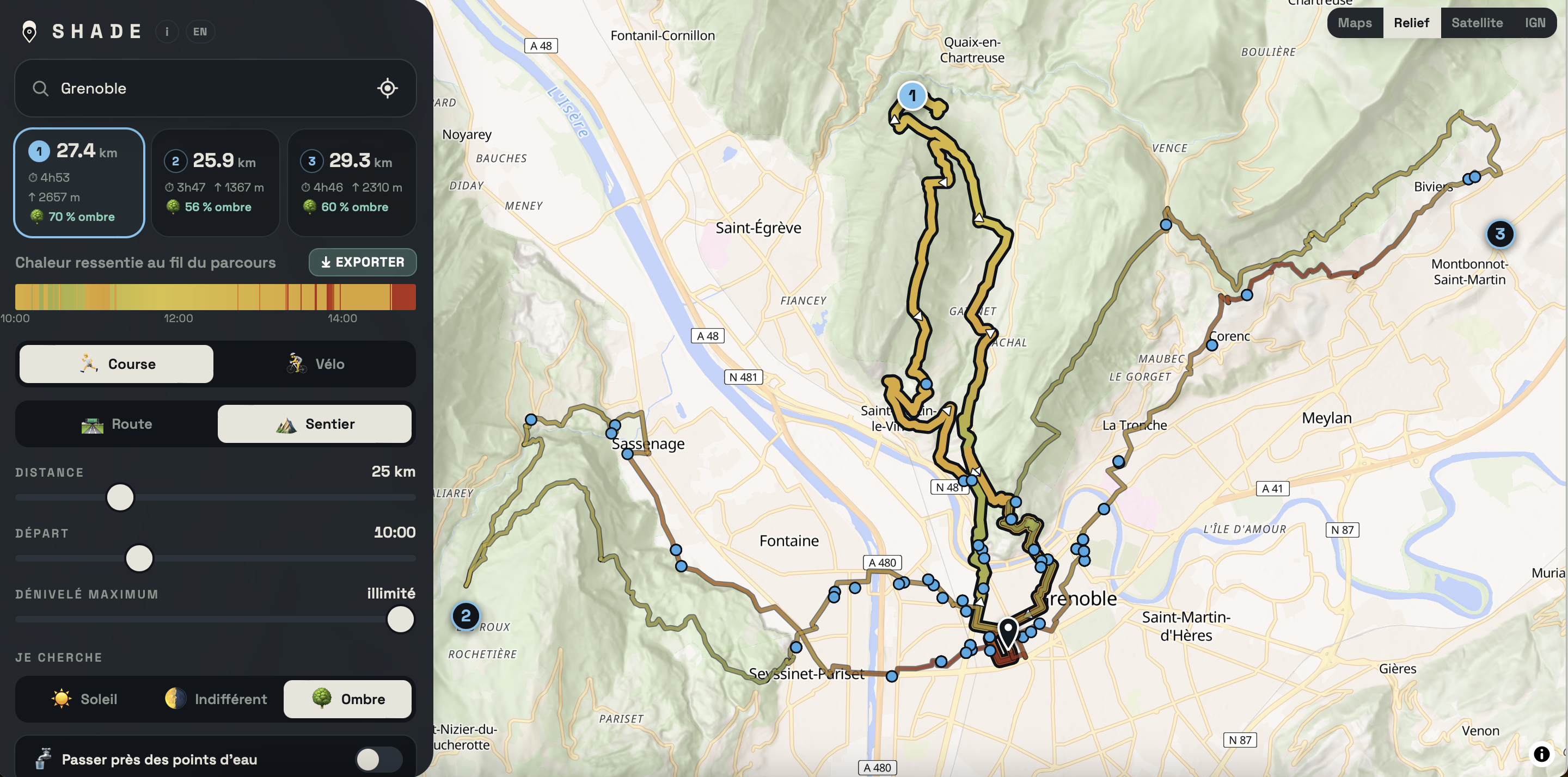
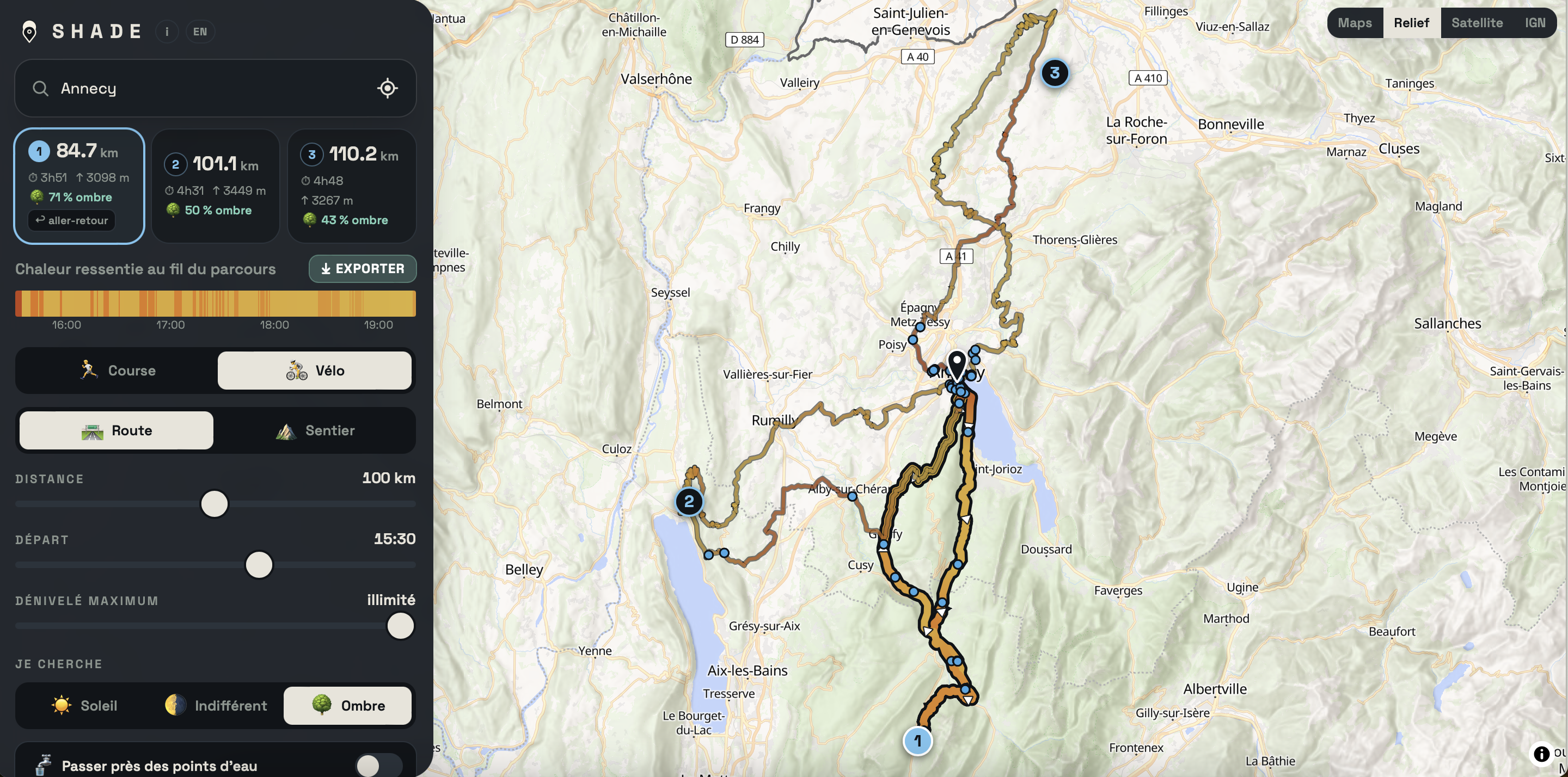
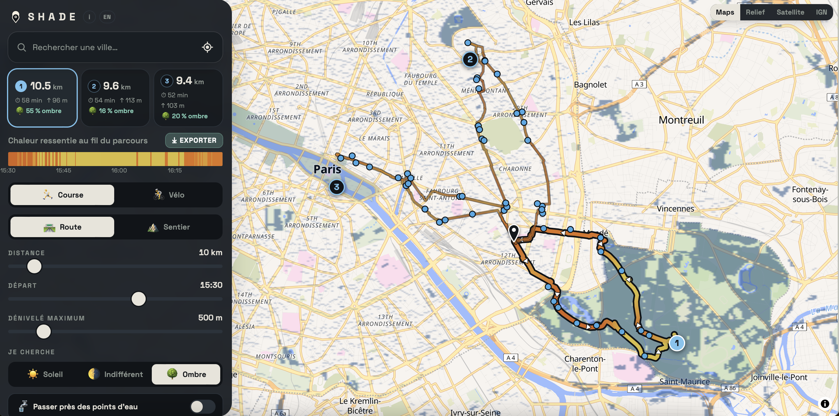
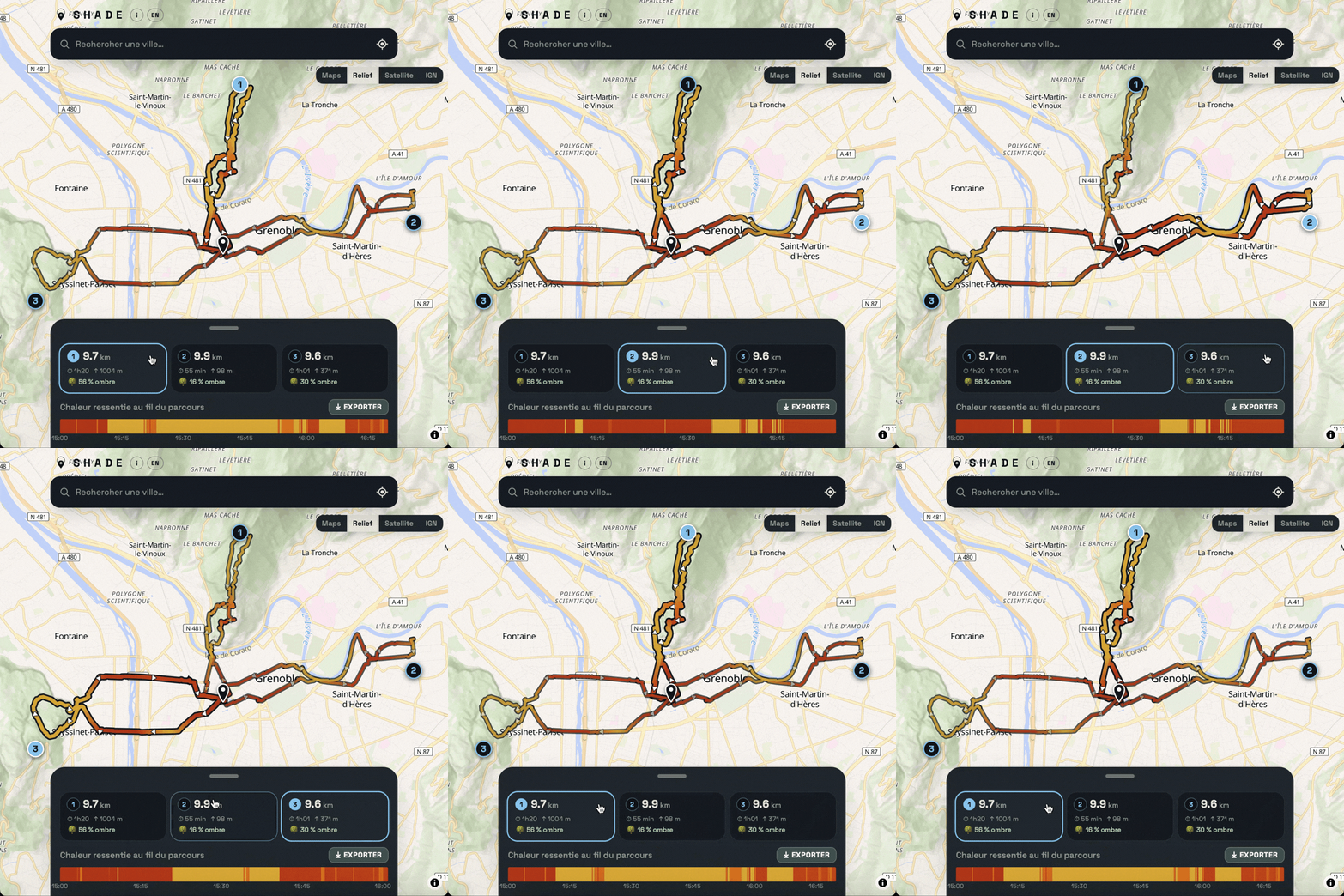
Three cities, three uses. Click for the full resolution (2880 px).
Elsewhere in Europe
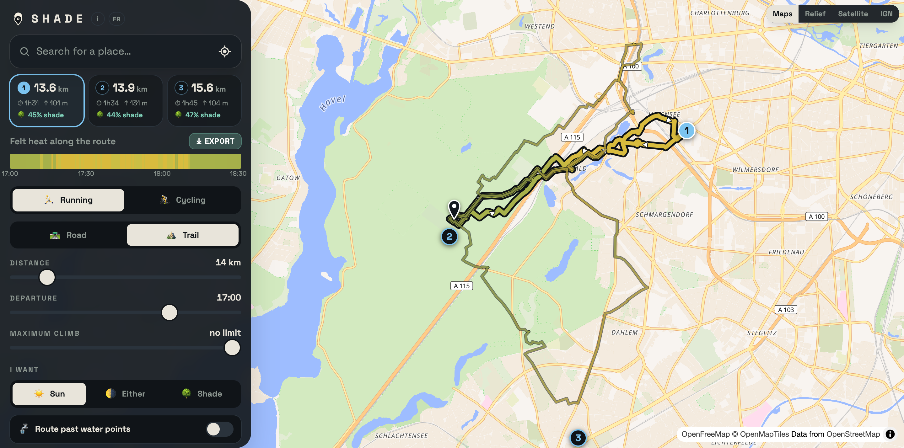
The engine works worldwide. Relief in the mountains, the plain map elsewhere — two of the four basemaps offered. Click for the full resolution.
Downloads


Permission to reuse
These visuals are free to use for press coverage, online and in print, with no prior request and no fee, in any article about SHADE. The logo may be cropped and cut out; please do not distort it or change its colours. Preferred credit: "SHADE — shaderoutes.com". The maps shown are based on OpenStreetMap: please include "© OpenStreetMap contributors" on the screenshots.
Fact sheet
| Name | SHADE |
| Website | shaderoutes.com |
| Launched | August 2026 |
| Price | Free, no advertising; account optional |
| Languages | French and English |
| Coverage | Worldwide |
| Data | OpenStreetMap (ODbL), OpenFreeMap, AWS Terrain Tiles; weather from Open-Meteo (ECMWF IFS, DWD ICON, Météo-France AROME/ARPEGE, NOAA GFS) and the ERA5 / ERA5-Land reanalysis |
| Privacy | No tracking cookies, no third-party trackers; the optional account stores an email address and settings, nothing else |
| Phone | +33 7 81 55 79 04 |
| Contact | contact@shaderoutes.com |
The creator
SHADE is built by Matthieu Renaudin, 24, based in Lyon, an engineer trained at École Centrale de Lyon and a runner. He made the tool for himself, after a summer in which every run ended in full sun and no app could tell him where the shade would be at the hour he set off.
He spent two months building the loop-search engine alone: tree canopy, terrain shadow, building shadow, and the sun's position hour by hour. The slopes around Grenoble served as the testing ground — the place where shade cast by hillsides becomes impossible to ignore.
SHADE is a personal project: free, no account, no ads, no tracking, and it will stay that way.
Available for interviews, demos, or to run one of the routes with you.